In order to map the localities of the rare and endangered plants along the route I will be using "Geosetter". Geosetter is a free software package links photos to their lat/lon co-ordinates. To do this you need a GPS that can track your route and a camera. The GPS (I have a Garmin GPSMap 60CSx) and the camera (Canon 400D) have their clocks set to exactly the same time. After downlaoding the photos and the GPS track Geosetter links each photo to its appropriate co-ords using the time to match them up. I have been looking into such technology for a while and Geosetter seems to be the easiest free way to achieve successful 'geotagging'.
The image shows the easy to use interface. On the left are the photos (you can navigate through your folders to find the pics you want), after selecting the photos you link them with the GPS file and like magic the google map shows up on the right to show you where you were.
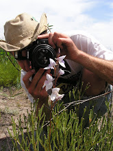
This image is from a walk in the Cape Point Nature Reserve.


No comments:
Post a Comment